
Exhibitions
Antique MapArt Australia is interested in organising events that focus on showing how antique maps are interesting, enjoyable, educational, and acquirable for the community. We see exhibitions as a key to achieving these aims and helping also non collectors to be aware of the beauty of antique maps. By crossing the educational aspect of Australian history with the beauty of early art we endeavor to nurture understanding of how Australia came to appear on the map. If you have an interesting idea or place for an exhibition encompassing Antique maps of the Australian region that you would like to let us know about please use our contact details provided.
Past Exhibitions
Hidden Treasures
|  |
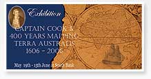 |
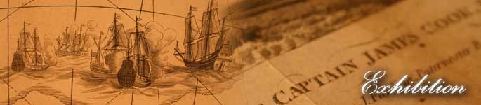
Captain Cook & 400 years mapping Terra Australis 1606 ??? 2006
Discover the Beauty of Antique Australian Maps! |
![]()
The exhibition 'Captain Cook & 400 years mapping Terra Australis 1606-2006' displayed one of the largest and most important collections of rare and valuable antique maps seen in Queensland . Celebrating Australia 's 400th anniversary of the first known European landing on Australian soil, the collection revealed the gradual emergence of Australia on the globe from its absence in the early 1500's until the appearance of Brisbane and Queensland in the mid 1800's. Maps charting the discoveries of such influential explorers as Captain Cook, Dampier, Tasman, Janszoon, Flinders, and Hartog were on display and a number of these pieces sold during the exhibition to local, interstate and international buyers.
The exhibition was officially opened on the evening of Thursday May 18 by Dr John Ryan with a special talk also given by Councilor Helen Abrahams. The exhibition was on display at Illustration House in the heart of the South Bank Parklands, Brisbane during May and June 2006. The exhibition was initiated by Troy Hamilton-Irvine, founder of Antique MapArt Australia and was a collaborative event between Antique MapArt Australia , Illustration House, and Gowrie Galleries.
The exhibition was in celebration of 400 years of the known European exploration of Australia , which was one of the many events occurring around Australia in 2006 (please see www.australiaonthemap.org.au for more information). The large display of maps showed how the world saw Australia in the distant past and watched its coastlines grow and develop over those 400 years.
To allow interstate and overseas visitors a chance to see the exhibition without actually coming to Brisbane an online catalogue of all the maps was created that detailed their importance and history. This allowed a world audience to enjoy this fascinating exhibition. All those involved in the exhibition hailed it as a success with well over a thousand local, regional, and overseas visitors attending.
Antique MapArt Australia would like to extend special thanks to all those involved in making the exhibition a success, to Illustration Houses beautiful gallery and staff, for the wonderful research, collection and advice of Gowrie Galleries, PureEvil Creative's web design and catalogue that allowed us to reach the nation, Blah Arts media design that captured the exhibitions essence, and Councilor Helen Abrahams assistance, and of course all of those behind the scenes who made such a huge contribution of their time.